


Oil Search Makes Progress
Friday, 16 March 2012
Afren Plc, a British oil firm exploring oil in Kenya has started the acquisition of 1800 km of 2D seismic in Block 1. The block 1 is located on the Western margin of the Mandera-Lugh basin in North Eastern Kenya bordering both Somalia and Ethiopia. This is a key step in the exploration of Block 1, which has not seen exploration activity since approximately 1990. The seismic crew first entered the area in late November last year. After building the seismic camp and logistical preparations, recording of new seismic data has now commenced.
The new seismic will help in delineate exploration prospects for drilling during 2013. Depending on rate of acquisition, the 1800 km survey should be completed during the third quarter of 2012. The partnership is utilizing real-time field processing and interpretation of the new data. The new seismic was planned in the first half of 2011 by the partnership after acquiring airborne gravity and magnetic data which defined it and the major basin geometry.
Afren operates the block 1 with a 50% working interest while Lion Petroleum holds acreage for exploration in Block 1 and 2B still in Kenya. The Mandera-Lugh sedimentary basin in North-Eastern Kenya continues partly into Somalia and Ethiopia where it is connected to the Ogaden basin.
http://www.kenyaengineer.co.ke/news/2-n ... -progress-
US Geologic Survey: oil in East Africa map
Moderators: Moderators, Junior Moderators
-
Voltage

- SomaliNet Super

- Posts: 29214
- Joined: Tue Oct 23, 2007 11:33 pm
- Location: Sheikh Voltage ibn Guleid-Shire al-Garbaharawi, Oil Baron
Re: US Geologic Survey: oil in East Africa map
-
Voltage
- SomaliNet Super
- Posts: 29214
- Joined: Tue Oct 23, 2007 11:33 pm
- Location: Sheikh Voltage ibn Guleid-Shire al-Garbaharawi, Oil Baron
Re: US Geologic Survey: oil in East Africa map
That same shadow British company Afren gave this overview two days ago
Afren Plc Provides 2011 Full Year Results for Kenya
Source: www.gulfoilandgas.com 3/27/2012, Location: Africa
...
Block 1
Overview
Block 1 is located on the western margin of the Mandera-Lugh basin in north-eastern Kenya bordering both Somalia and Ethiopia, where it is connected to the Ogaden basin. The Upper Triassic and Jurassic formations that have been identified are considered to be the primary zones of oil prospectivity. An oil seep close to the Tarbaj-1 well in the south-west corner of the block confirms the presence of hydrocarbons. Analogous data with the Ogaden basin also suggests there may be other potential source rocks and reservoirs. The Bur Mayo and the Kalicha-Seir formations in the Mandera-Lugh basin appear comparable to the Lower and Upper Hamanlei (Jurassic) formations in the Ogaden basin. If analogous, these formations should have high total organic content (TOC) source rocks and good quality reservoirs.
Several major structures have already been mapped on the block, that currently has 850 km of existing 2D seismic coverage. During the first half of 2011, the partners successfully acquired airborne gravity and magnetic data, the results of which have been encouraging and have been used to target an additional 1,800 km of 2D seismic data on the block.
2012 outlook
The partners on Block 1 have commenced the acquisition of the planned 1,800 km of 2D seismic data and are targeting completion of this and further seismic interpretation during 2012.
http://www.gulfoilandgas.com/webpro1/MA ... p?id=19418

Re: US Geologic Survey: oil in East Africa map
I never knew the MJ crew was so petty and envious. When the Puntland Oil subject came up all the MR said Mashallah. These guys can't manage the same? 
Voltage,
Great info. I even heard the TFG interior Minister speaking on this the other day.
Voltage,
Great info. I even heard the TFG interior Minister speaking on this the other day.
-
Starscream

- SomaliNet Heavyweight

- Posts: 2526
- Joined: Mon Sep 10, 2007 11:16 am
- Location: Qardho District.
Re: US Geologic Survey: oil in East Africa map
Says the ilkoyar who are following every step we take. Get real losers you guys will never achieve anything as great as Majerteens. Have fun digging up false hopes.Murax wrote:I never knew the MJ crew was so petty and envious. When the Puntland Oil subject came up all the MR said Mashallah. These guys can't manage the same?

Re: US Geologic Survey: oil in East Africa map
Beesha SADE won
1. Breadbasket ✔
2. Oil ✔
3. Kismayo ✔
Jubbaland State of Somalia ✔✔✔


Last edited by Advo on Fri Mar 30, 2012 12:57 am, edited 1 time in total.
Re: US Geologic Survey: oil in East Africa map
Starscream wrote:Says the ilkoyar who are following every step we take. Get real losers you guys will never achieve anything as great as Majerteens. Have fun digging up false hopes.Murax wrote:I never knew the MJ crew was so petty and envious. When the Puntland Oil subject came up all the MR said Mashallah. These guys can't manage the same?


I know its hard to fathom, when a lush, green area also punishes Your desert lands in oil reserves
-
Starscream
- SomaliNet Heavyweight
- Posts: 2526
- Joined: Mon Sep 10, 2007 11:16 am
- Location: Qardho District.
Re: US Geologic Survey: oil in East Africa map
What have you guy accomplished though? I am sure siad barre's money ran out by now.

Re: US Geologic Survey: oil in East Africa map
Jubaland Future on top, Puntland Future on bottom 

-
Starscream
- SomaliNet Heavyweight
- Posts: 2526
- Joined: Mon Sep 10, 2007 11:16 am
- Location: Qardho District.
Re: US Geologic Survey: oil in East Africa map
Puntland in 2015

Jubbaland in 2015

Have fun in your slums haters.
Jubbaland in 2015
Have fun in your slums haters.
-
Voltage
- SomaliNet Super
- Posts: 29214
- Joined: Tue Oct 23, 2007 11:33 pm
- Location: Sheikh Voltage ibn Guleid-Shire al-Garbaharawi, Oil Baron
Re: US Geologic Survey: oil in East Africa map
So jealous it is sad wallahi. Practically all of Gedo is hydrocarbon is active. They are like WHAT? HOW?
Anyways this isn't zero sum. I would love to see oil prospects pick up In Afgooye, Bakool, of shore Banadir, and the rest of Somalia. The losers are the ones who want to be the ONLY ones with prospects for some worthless vanity. That's what the responses in this topic exposed. Ciil u dhimta
Anyways this isn't zero sum. I would love to see oil prospects pick up In Afgooye, Bakool, of shore Banadir, and the rest of Somalia. The losers are the ones who want to be the ONLY ones with prospects for some worthless vanity. That's what the responses in this topic exposed. Ciil u dhimta
-
Eaglehawk

- SomaliNet Heavyweight
- Posts: 3557
- Joined: Sun Dec 27, 2009 3:33 pm
- Location: God, Clan and Country
- Contact:
Re: US Geologic Survey: oil in East Africa map
this is big
No wonder the Americans always kept close relations with marexaan even though our future power prospect looked glim in 1991
voltage i saw one of your threads back in the day, when al shabab took over kismaayo and how the american embasador in kenya Michael Ranneberger wanted iin uu gubaabiyo marexaan saying "kismayo was taken over by clans"
even if you look now the west is arming marexaan heavily with the consent of ethiopia and kenya.
in fact doolow is the western worlds command center in the fight against al shabab, you have more intelligence and milllitry officiers in doolow then xamar
there is something big going on in jubaland and this oil information completes for me personaly the picture
this era is facing grand plan that is beyon the somali grasp.
praise allah: alahhu akbar, alhahu akbar
-
Starscream
- SomaliNet Heavyweight
- Posts: 2526
- Joined: Mon Sep 10, 2007 11:16 am
- Location: Qardho District.
Re: US Geologic Survey: oil in East Africa map
looooooooooooool@cil u dhimta, aren't you the one trying way too hard to be on Puntlander's tip? get off it, we too busy deciding what to buy with our oil money. 


Re: US Geologic Survey: oil in East Africa map
Since when has it been cool to be a project started by Kenya...Advo wrote:
Beesha SADE won
1. Breadbasket ✔
2. Oil ✔
3. Kismayo ✔
Jubbaland State of Somalia ✔✔✔
-
Voltage
- SomaliNet Super
- Posts: 29214
- Joined: Tue Oct 23, 2007 11:33 pm
- Location: Sheikh Voltage ibn Guleid-Shire al-Garbaharawi, Oil Baron
Re: US Geologic Survey: oil in East Africa map
May Puntland see the best of success as soon as possible. Meanwhile in Gedo, the future as an oil rich region is being uncovered with parts of our basin in neighboring countries being successfully penetrated. For Gedo it is not if but WHEN. Sorry it bothers you to the bones.Starscream wrote:looooooooooooool@cil u dhimta, aren't you the one trying way too hard to be on Puntlander's tip? get off it, we too busy deciding what to buy with our oil money.
-
Voltage
- SomaliNet Super
- Posts: 29214
- Joined: Tue Oct 23, 2007 11:33 pm
- Location: Sheikh Voltage ibn Guleid-Shire al-Garbaharawi, Oil Baron
Re: US Geologic Survey: oil in East Africa map
I don't know what suppositions I can derive, but I do know that;Eaglehawk wrote:this is big
No wonder the Americans always kept close relations with marexaan even though our future power prospect looked glim in 1991
voltage i saw one of your threads back in the day, when al shabab took over kismaayo and how the american embasador in kenya Michael Ranneberger wanted iin uu gubaabiyo marexaan saying "kismayo was taken over by clans"
even if you look now the west is arming marexaan heavily with the consent of ethiopia and kenya.
in fact doolow is the western worlds command center in the fight against al shabab, you have more intelligence and milllitry officiers in doolow then xamar
there is something big going on in jubaland and this oil information completes for me personaly the picture
this era is facing grand plan that is beyon the somali grasp.
praise allah: alahhu akbar, alhahu akbar
1. Exploration is occurring right now around us.
2. Gedo occupies most of the Mandera-Lugh hydrocarbon-rich basin.
3. There have been actual discoveries both on our border with Ethiopia and now Kenya.
4. That even the tracts are tailored right to our border outline showing the seep cuts right into our region if it is not the heart.
From that we can conclude the prospects for oil is not speculative but rather confirmed.
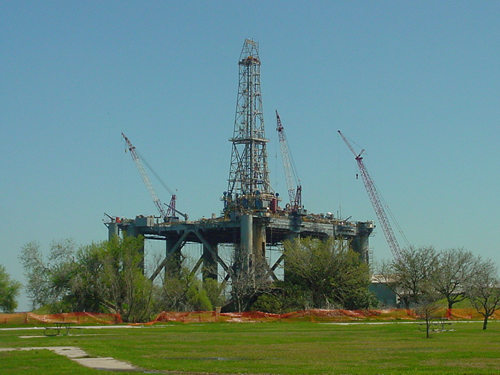
The question is when will the largest part and the heart of the Mandera-Lugh basin (GEDO) be officially prospecting publicly? I honestly envision this image to become a reality in Gedo region but the question is WHEN?
Last edited by Voltage on Fri Mar 30, 2012 2:26 am, edited 1 time in total.
-
- Similar Topics
- Replies
- Views
- Last post
-
- 0 Replies
- 339 Views
-
Last post by American-Suufi
-
- 6 Replies
- 3783 Views
-
Last post by Batwing
-
- 1 Replies
- 2437 Views
-
Last post by Mckuus
-
- 24 Replies
- 5416 Views
-
Last post by Jamac_Yare
-
- 5 Replies
- 1651 Views
-
Last post by Nomand
-
- 11 Replies
- 2111 Views
-
Last post by DisplacedDiraac
-
- 64 Replies
- 8315 Views
-
Last post by paidmonk
-
- 17 Replies
- 3277 Views
-
Last post by Aliyah99
-
- 6 Replies
- 2194 Views
-
Last post by Kramer
-
- 1 Replies
- 899 Views
-
Last post by abdisamad3