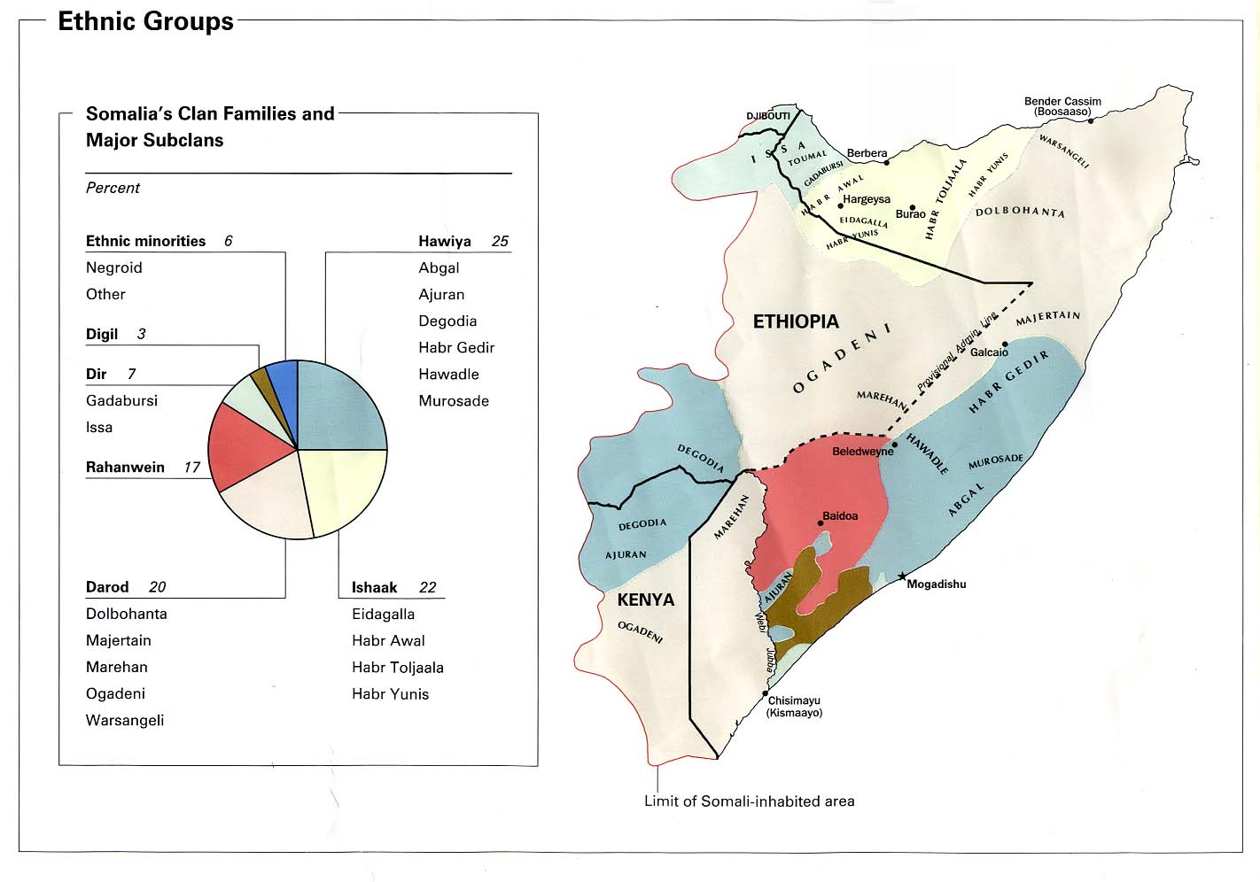
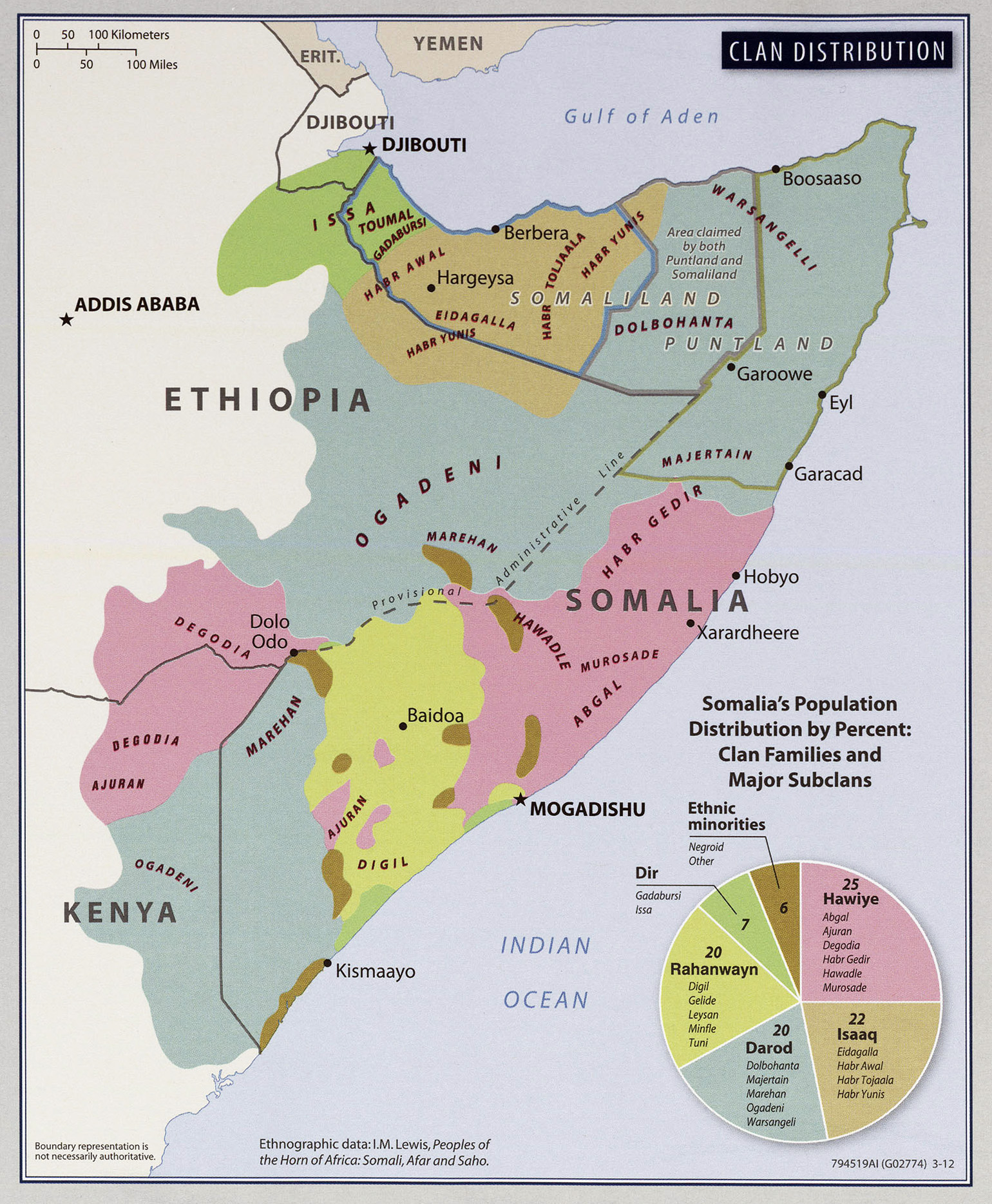
Is that what bothers you ... Sanaag. Look, the HY land expands all the way to the sea (there are not far from Bosaso) and just for the record this map was made in 1977 by the US (When the Darood government facilitated the ownership of lands to the Warsangali & Dhulus) several copies have been made from this map most recently 2012
http://www.lib.utexas.edu/maps/africa/t ... distro.jpg
But in essence, they are all the same and does not represent the reality on the ground.Today we have advanced in Sool and Sanaag and have more lands but We lost a large population due to the events of 88 and so did the southerns with the endless blood shed, famine and tribal wars. I agree it is not accurate but its the best source so far

Ps: the map clearly shows Erigavo and beyond within the HY areas, it might be mistaken because the boundaries of the old regions are not drawn. But it does not show HJ settlements in Xudun why? because the majority are Dhulus back then! The FSNAU did not make that map the US did when the Kacan settled its people there. They have nothing to do with Qabiil matters. All in all, it's just an assumptions don't take it to the heart

TGS
Funny cos of all people, Darood used from these info's in creating a delusion that they are the most numerical clan in Somalia. Sanaag is shared, but southern people think of Warsangali when they hear that name so does Sool and Cayn. In Jubaland, there is many clans live there many are larger than Darood but again Darood jumps to your mind when they hear the name (some actually use the entire population of non-Darood and boast about it as a Darood exclusive region). The same is with Kilil 5 the only deference is, you are a big clan there probably the biggest but you get my point. Until a proper census takes place. I am afraid any one could claim anything


