Page 2 of 2
Re: Questions about locations for Sanaagians
Posted: Wed Jan 20, 2016 7:17 pm
by HooBariiska
Djiboutian wrote:@Xplaya

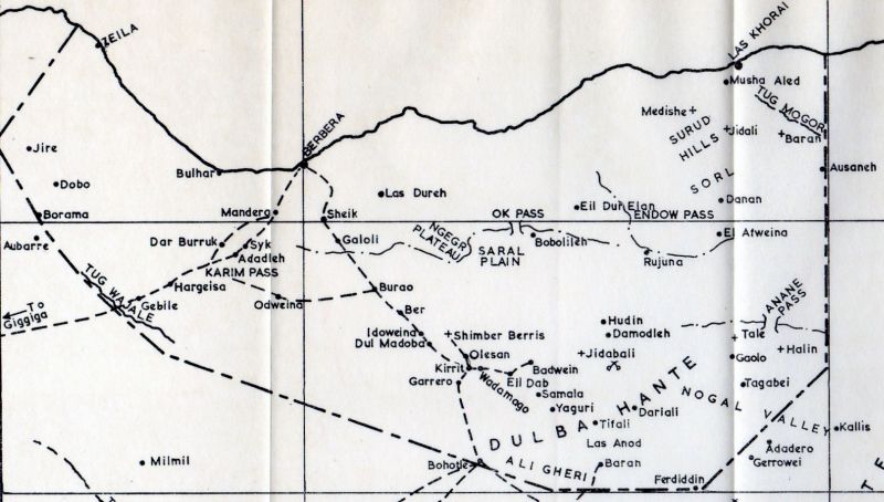
Let me know if you want more maps
is this a real map? doesnt look accurate to me at all
Re: Questions about locations for Sanaagians
Posted: Wed Jan 20, 2016 7:23 pm
by Djiboutian
theyuusuf143 wrote:marka beer waqooyi bare looga baxo waxa kutaal tuulo la yidhaahdo ceel dheere. beri aan meel ina afmadoobe/magaalo cad agteeda kutaal geel ku raacay waxa kutaalay xabaashii koofil. oday deegaanka u dhashay wuxu ii sheegay in gabadh uu koofil dhalay meesha aabahaeed tomb uga dhistay. xabaasha meel ku dhaw waxa ka baxa xagaaf ama jid fardood ay baneeyeen fardihii badnaa ee daraawiishta, jidkaas oo toos ugu aadan dhanka beereed.
Ardaaga halka degan kuwi hore u dagi jiray maha sida awgeed aqoon badan oo ma'laha degaanka. At the time of Dul Madoba " Dhul Madoobe " battle another sub clan used to live there than the one who settle now. Therefore, when Mr. Mr. Jeffrey Bartholet accompanied Mr. Mohamed Ibrahim " Hadrawi" to visit Richard Corfield's burial place back in 2009, the guide showed them old tomb which was built before Islam existed in Somaliland.
http://europe.newsweek.com/muhammad-abd ... 9127?rm=eu
HooBariiska wrote:Djiboutian wrote:@Xplaya

Let me know if you want more maps
is this a real map? doesnt look accurate to me at all
Excuse me, are you Xplaya?
Re: Questions about locations for Sanaagians
Posted: Wed Jan 20, 2016 7:50 pm
by HooBariiska
^^ homeboy if u gonna draw something can u atleast make it look realistic, this is the most pathetic map i've seen
Re: Questions about locations for Sanaagians
Posted: Thu Jan 21, 2016 1:15 pm
by X.Playa
Djiboutian wrote:@Xplaya

Let me know if you want more maps
very good map , it conatins mot of the places I needed , thanks a lot, but what do they mean by "pass" ma buur hoosteed oo la maraa , mise dusheed ??? in Annane pass above Taleex?? is there mouantains around Taleex, ??
Re: Questions about locations for Sanaagians
Posted: Thu Jan 21, 2016 5:18 pm
by Djiboutian
The map is not so accurate. Look where El Afweyn is placed?
http://i.imgur.com/O5vqJkP.jpg
This map is more accurate. It was drew in 1948. It shows the dry rivers, plains, mountains, hills .. etc. Notice no mountains around Taleh
http://i.imgur.com/NRxt2PL.jpg
Pass wa laba buur dhexdood.