
My question is does this map represent the actual border between the two European colonizers, England and Italy?

Moderator: Moderators


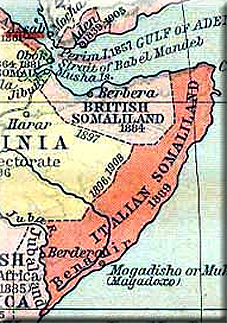


Their main center of business was the town of Bander Ziyada. This city was destroyed and abandoned by the British colonialists when colonial rule divided the Somali territory into five parts[2] since it lay on the border line between British Somaliland and Italian Somaliland.
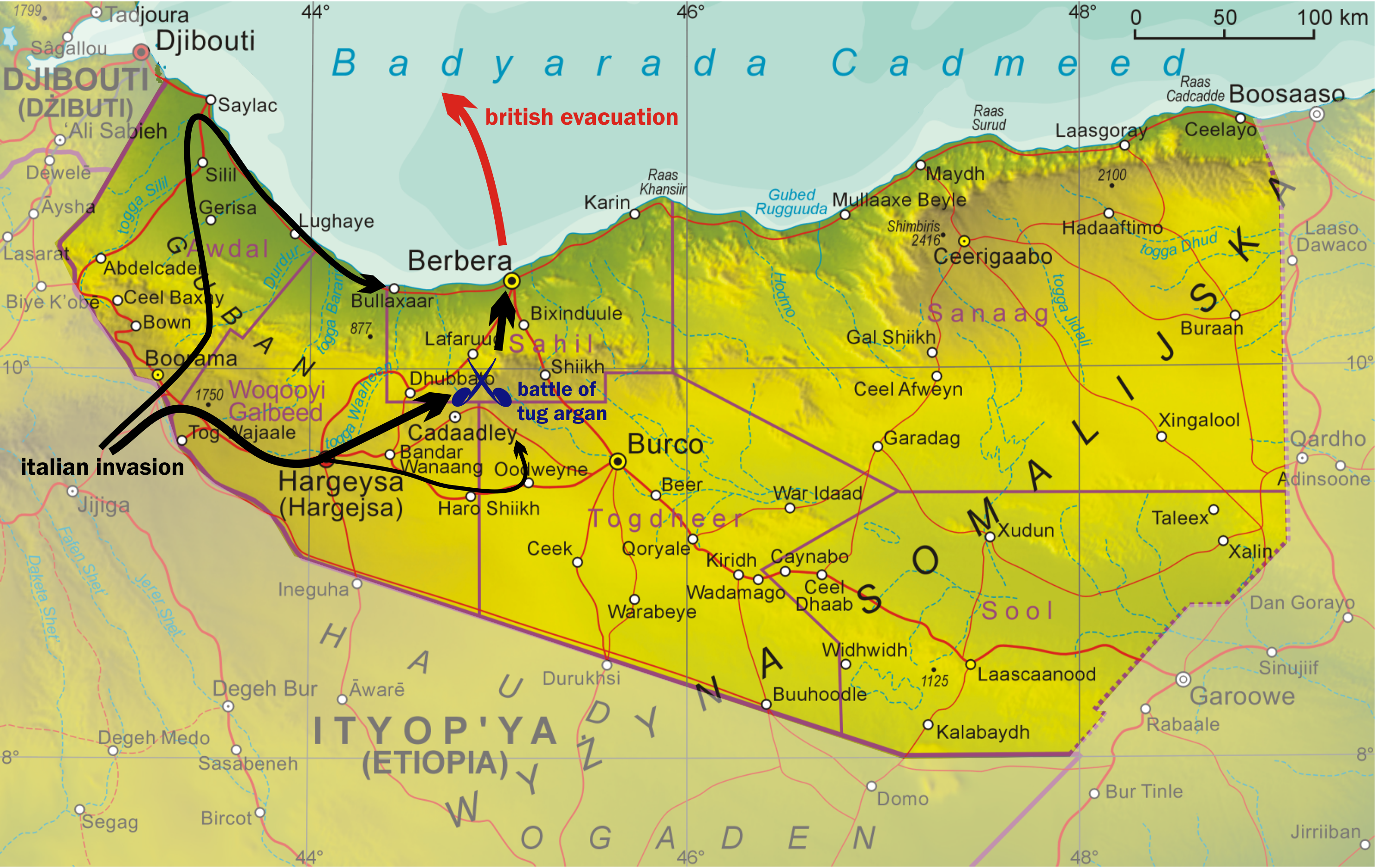
GREAT! NOW THE QAT-ADDICTS ARE GOING TO TRY TO CLAIM QARDHO FARMS AND PL NAVAL BASEChinaman wrote:Parts of Qardho like Kubo and the farms along with some tuulos that are part of degaanka qardho (Dhaxan, Weylo etc) were originally part of the former British Somaliland. If you go north, degaanka waaciye was part as well.
Near Bosaaso the border is in Bandar Ziyada/Qaw which was actually destroyed by the British because it sat right on the border betwen the two but has since been rebuilt:
Their main center of business was the town of Bander Ziyada. This city was destroyed and abandoned by the British colonialists when colonial rule divided the Somali territory into five parts[2] since it lay on the border line between British Somaliland and Italian Somaliland.


You and me can discuss it all we want according to international law and the AU charter and that which constitutes a Mordern state border. Puntland is in voilation of the border of it's neighbour.tightrope wrote:^^
YOU'RE CALLING PUNTLANDERS EXPANSIONISTS?
ISAAQ ARE THE ONES TRYING TO CLAIM WARSANGELI AND DHULBAHANTE LAND.

Cirwaaq wrote:You and me can discuss it all we want according to international law and the AU charter and that which constitutes a Mordern state border. Puntland is in voilation of the border of it's neighbour.tightrope wrote:^^
YOU'RE CALLING PUNTLANDERS EXPANSIONISTS?
ISAAQ ARE THE ONES TRYING TO CLAIM WARSANGELI AND DHULBAHANTE LAND.
Now you might think it smart or rather funny to twist your delusion and make it someone else's fault but in the long run you are denying ALL those we left behind in the Desert a chance to live in peace.
Respect the borders of your neighbours... If you are true in your quest to free land belonging to somali people then please go free NFD and Ogadeen first.

tightrope wrote:Cirwaaq wrote:You and me can discuss it all we want according to international law and the AU charter and that which constitutes a Mordern state border. Puntland is in voilation of the border of it's neighbour.tightrope wrote:^^
YOU'RE CALLING PUNTLANDERS EXPANSIONISTS?
ISAAQ ARE THE ONES TRYING TO CLAIM WARSANGELI AND DHULBAHANTE LAND.
Now you might think it smart or rather funny to twist your delusion and make it someone else's fault but in the long run you are denying ALL those we left behind in the Desert a chance to live in peace.
Respect the borders of your neighbours... If you are true in your quest to free land belonging to somali people then please go free NFD and Ogadeen first.
WHY WOULD I RESPECT BORDERS CREATED BY EUROPEAN COLONIALISTS?
SOMALIA AND SOMALILAND NEVER EXISTED BEFORE BRITS AND ITALIAN INVADED.
TELL YOUR QAT-ADDICTED MASTERS TO RESPECT CLAN BORDERS.


