


Anyone remembers forgeries we found like the British archival "official record' of thr Letter to the British King allegedly from Darod clans "including Marehan" but which actually did not include Marehan in the originals?

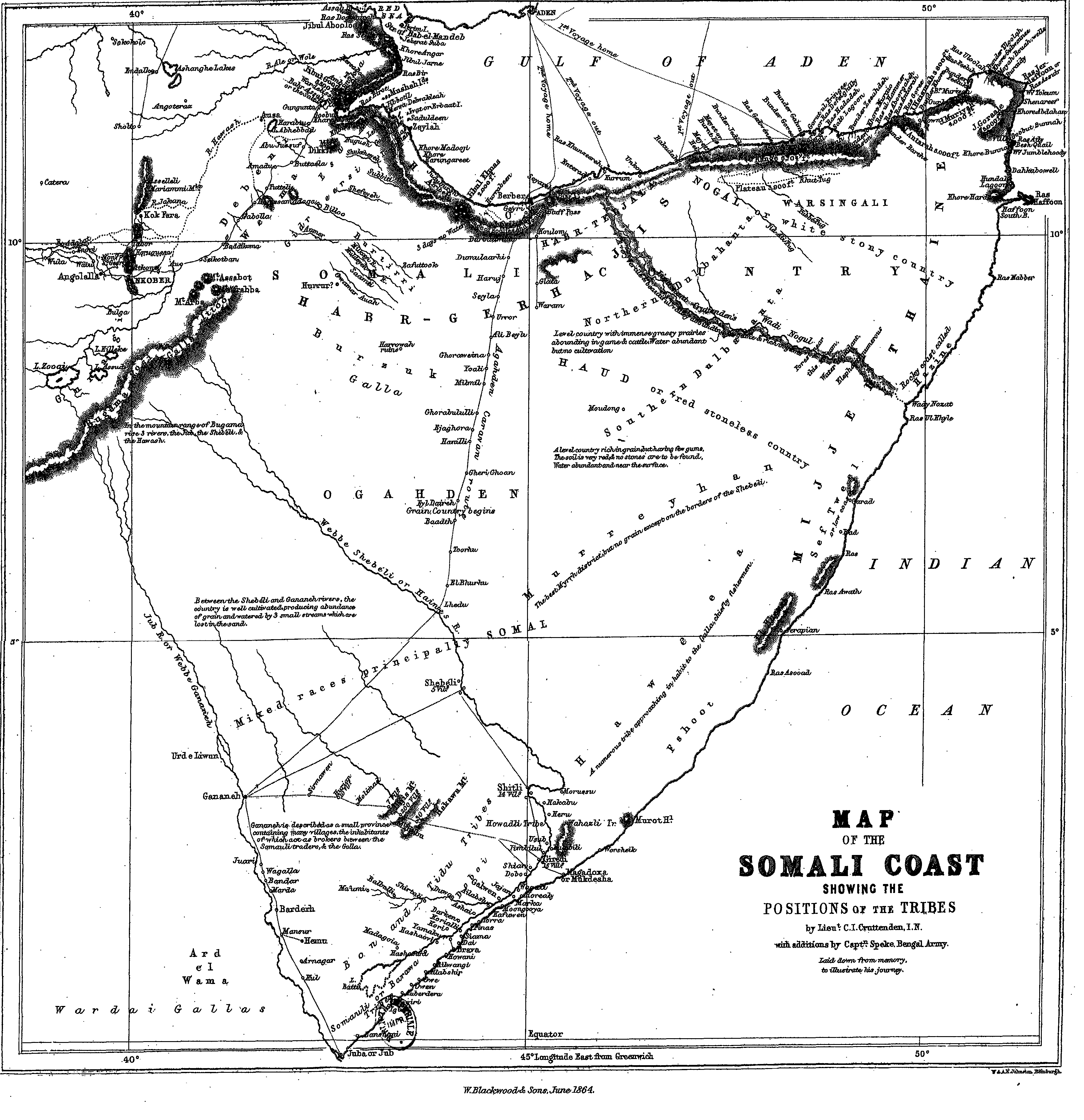
Well apparently, the British archival "official record" of CRUTTENDEN'S MAP (at least the Map so far) is not actually the original either. It is politically doctured with and anybody who knows anything elementary about Somali geography and history knows what is going on here. Remember also this was thr beginning of British colonialism so controlling "imagery" of land settlement was important weapon for controlling legitimacy to land ownership.
In general, it seems principally designed to push British sphere WESTWARDS and the Somali boundary generally Westward.
This has the effect of politically biasing two specific clans if we look at CRUTTENDEN'S ORIGINAL MAP.
Marehan and Dhulbahante take the brunt of the political altering of the original map.
I would include Ogadeni, but Ogadeni were never considered Italian sphere so however west the boundary between Ethiopia and Italian Somaliland was pushed was a gain for them as they would then inherit the land disappropriated from Marehan as they did with Shilaabo for instance.
The British archival "official record" of CRUTTENDEN'S Map (we have all seen this map a million times)

The actual ORIGINAL CRUTTENDEN'S MAP according to John Hanning Speke's records (Speke was a companion of Burton and ended up finding the base of the Whíte Nile in Uganda

A big detailed version of it ---> https://www.gutenberg.org/files/8417/images/map-a.png
And the difference

What else have the British tampered with and changed between the original and the "official" records? Every other week it is something new.


